
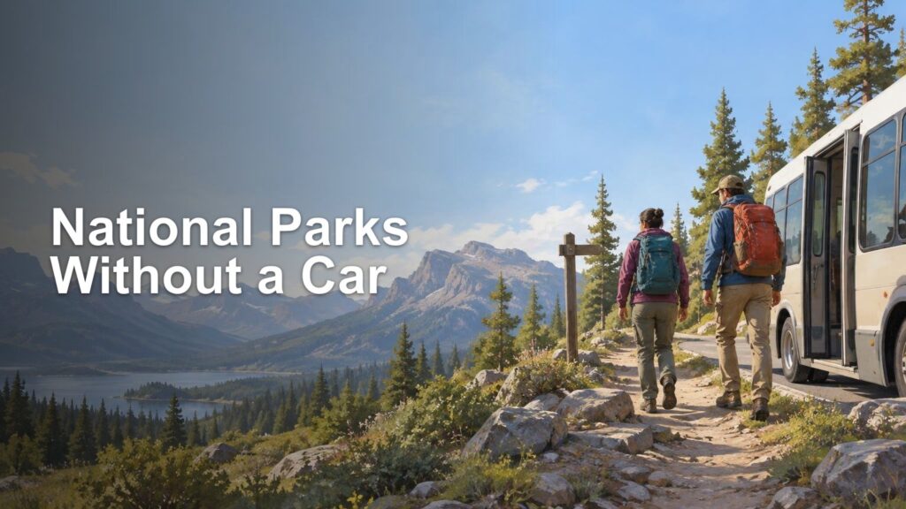
TLDR: The key to learning how to visit national park without a car is checking the entire transportation chain before booking. You need a workable route from your airport, train station, or intercity bus stop to a gateway town, suitable lodging, the park entrance, your chosen trailheads, food, and finally back to your departure point. An in-park shuttle alone does not make the whole trip car-free.
A no-car national park vacation can be easier than driving in a few well-connected places, but it rewards detailed planning. Instead of asking only whether a park has a shuttle, test every connection for your exact travel dates. Seasonal schedules, limited departures, reservations, bicycle rules, and the location of your lodging can turn a promising itinerary into either a smooth trip or a long wait beside a very scenic road.
How to visit national park without a car: the six-link test
Think of the trip as six connected links. If any one of them fails, the itinerary needs a different lodging base, different activities, another arrival day, or a backup transfer.
- Arrival hub: Identify the airport, train station, or intercity bus stop where the practical ground journey begins.
- Gateway transfer: Confirm how you will reach the park region or gateway town, including service days, required reservations, luggage rules, and the final departure of the day.
- Overnight base: Choose lodging within a realistic walk of the transit stop, park entrance, or tour pickup point.
- Park entry: Verify how you will travel from the lodging base into the park and whether that connection operates during your dates.
- Daily mobility: Match every hike, viewpoint, campground, meal stop, and necessary facility to an actual route and stop.
- Return journey: Build the outbound trip separately, including the first available service, transfer time, and a missed-connection backup.
This chain matters because National Park Service buses and shuttles are generally designed to move visitors within busy park areas and reduce pressures such as traffic, parking, noise, and pollution. They are not necessarily designed to collect travelers from a distant airport or serve every trailhead. The National Park Service overview of park buses and shuttles is a useful starting point, but each park and transit operator publishes its own details.
Choose an arrival hub by connections, not distance
The closest airport is not automatically the best airport. A more distant hub with a direct, dependable bus may be more useful than a nearby airport where the only onward option is an expensive or uncertain private transfer.
Compare hubs by looking at the full ground itinerary. Check which days the gateway service operates, whether it requires advance booking, how much transfer time you have after landing, and whether the same connection works in reverse on departure day. If the last bus leaves before an evening flight arrives, the route is not viable without an extra hotel night or another transfer.
Apply the same test to rail and intercity buses. A station bearing the name of a famous destination may still be many miles from the entrance or from the part of the park you want to explore. Write the journey as a timetable rather than a vague sequence: arrival time, transfer walk, connector departure, gateway arrival, lodging check-in, and the last practical alternative if something runs late.
Allow a meaningful buffer between separately booked services. Airlines, trains, and regional buses do not necessarily protect a connection booked with another operator. The final outbound transfer deserves the largest margin because missing it could also mean missing a flight or train.
Pick lodging as part of the transportation system
Without a car, lodging location often matters more than room price alone. A cheaper property several miles from the shuttle stop may create a rideshare dependency, while a modest room near a pedestrian entrance or transit hub can simplify every day of the trip.
Check the walking route on a map rather than relying on a description such as “near the park.” Look for sidewalks or safe paths, road crossings, lighting, elevation, and the distance you will cover with luggage. Also check how you will reach groceries, restaurants, and drinking water. A shuttle-friendly hotel is less useful if dinner requires a trip beyond the final bus.
There are three common lodging strategies. Staying inside the park can reduce daily transfers but may cost more or book early. Staying beside a park entrance works well when a town shuttle or pedestrian entrance connects directly to the in-park network. A gateway-town base offers more food and lodging choices, but only if its regional connector and park service align with your itinerary.
If you are comparing a car-free itinerary with a driving vacation, the same principles of choosing efficient overnight bases and protecting actual park time apply. Our guide to planning a national park road trip without spending the whole trip in the car provides a useful comparison framework.
Read a shuttle map like a hiker
A colored line passing through the park is not enough. Start with the specific hike, viewpoint, visitor center, campground, or activity you want, then find its closest stop. Confirm that the stop is served in both directions and that the walking route from the stop is practical.
For every planned outing, record these details:
- The route name and exact boarding stop
- Operating dates and days of the week
- First departure, service frequency, and final return
- Travel time and any required transfer
- Fare, reservation, ticket, or entry requirements
- Whether large packs, strollers, mobility devices, or bicycles are accepted
- The walk between the stop and the actual trailhead
- A turnaround time that gets you back before the last service
Build the day backward from the final ride, not forward from breakfast. If a trail takes longer than expected, the last shuttle is the deadline that matters. Keep enough margin for rest stops, route-finding, weather, and the fact that the group member who said “one more viewpoint” may not be holding the timetable.
Save current schedules offline and take a screenshot of the relevant map. Cell service can be limited, and a bookmarked webpage is not much help when it cannot load. Check the park’s alerts and trail conditions shortly before setting out as well.
Three workable models—and their limits
Zion: gateway town plus pedestrian entrance and park shuttle
Zion demonstrates how a gateway town can function as part of the park transportation network. The Springdale Line connects locations in Springdale with the park’s pedestrian entrance; visitors can then cross a footbridge to the Zion Canyon Visitor Center and connect with the park shuttle. During shuttle season, personal vehicles cannot use Zion Canyon Scenic Drive, so shuttle planning is central even for many visitors who arrive by car. Current schedules are seasonal and should be checked on the official Zion Canyon Shuttle System page.
This model works best when lodging is close to a Springdale stop and the planned activities are served by the canyon shuttle. It does not answer the separate question of how you will reach Springdale from a regional airport or intercity transport hub. That first and final segment must be planned independently.
Yosemite: regional access with an uneven in-park network
Yosemite illustrates why travelers must plan by park area rather than treating a national park as one transit-served destination. Its official transportation guidance separates access to different regions and notes that options may be seasonal, fee-based, dependent on reservations, unavailable in some years, or absent from a particular area. Hetch Hetchy, for example, has no public transportation.
A car-free Yosemite itinerary therefore needs a tightly defined base and activity list. Confirm that regional transportation reaches your lodging area and that each planned trail or attraction is accessible from the service available during your dates. A bus into Yosemite Valley does not automatically create access to every road, grove, or high-country trailhead.
Acadia: community connections with limited bike integration
Acadia’s Island Explorer is another useful model. The official park information describes fare-free service connecting park destinations, local communities, Bar Harbor–Hancock County Regional Airport, campgrounds, carriage-road entrances, and many trailheads. Buses have wheelchair lifts and bicycle racks, but bicycle capacity and accepted-bike rules are limited. The service also does not reach the summit of Cadillac Mountain.
That combination can support a trip based around Bar Harbor or another served community, especially when activities line up with the published routes. It still requires checking seasonal operation, the precise stops for your lodging and hikes, and whether relying on a bike rack is realistic. A rack with limited capacity is a useful option, not a guaranteed connection.
Use bikes, walking, and tours to solve specific gaps
Supplementary transportation can expand a car-free itinerary, but each tool solves only certain problems.
| Option | What it can solve | What to verify |
|---|---|---|
| Walking | Short links between lodging, food, entrances, and shuttle stops | Safe route, distance, hills, weather, darkness, and luggage |
| Bicycle | Moderate last-mile distances and access from a transit stop | Road suitability, park rules, bike type, rack capacity, storage, and return timing |
| Guided tour | Access to selected viewpoints or areas outside a shuttle route | Pickup location, included stops, time at each stop, luggage rules, and cancellation policy |
| Taxi or rideshare | An occasional transfer or emergency backup | Actual local availability, pickup coverage, cell service, and whether advance booking is possible |
A bicycle works best when the route itself is suitable and you can complete it even if the bus rack is full. Do not assume an operator accepts e-bikes, fat bikes, trailers, or a fully loaded touring bicycle. Confirm the rule with the transit provider serving your exact route.
Tours can bridge a difficult transportation gap, but they trade independence for a fixed itinerary. A sightseeing tour may reach major overlooks without giving you enough time for a long hike. It may also return to a pickup point far from your lodging. Treat the tour as one scheduled segment, not as general transportation for the day.
Know when a no-car trip is a poor fit
Some parks, regions, seasons, and itineraries are difficult without a vehicle. North Cascades is a useful caution: the park has stated that little of it is directly accessible by public transportation even though transit connections may exist in gateway communities. Because the supplied park page is older, current operators must be checked before relying on any specific service. The broader lesson remains important: reaching a gateway does not mean you can reach the park’s trails or developed areas.
A no-car plan may be a poor match when the desired trailheads are widely dispersed, the only connector operates on limited days, lodging lies beyond walking distance, or the final return leaves too early for your planned activities. It can also become fragile when the whole trip depends on one daily departure with no practical backup.
Instead of forcing the destination, narrow the itinerary to one well-served district, change seasons, book a guided day, or choose a park region with a more complete transit chain. Grand Canyon Village and the developed South Rim, for example, have a free shuttle network, but that should not be generalized to the separate access situation at the North Rim.
Final car-free departure checklist
- Recheck every operator’s schedule for your exact dates.
- Confirm reservations, tickets, fares, and park-entry requirements.
- Save route maps, schedules, confirmation numbers, and addresses offline.
- Verify the final bus or shuttle from each hike and the final gateway connection.
- Allow extra time between separately operated services.
- Confirm luggage, backpack, mobility-device, pet, and bicycle rules where relevant.
- Carry enough food and water for delays; do not assume every stop has services.
- Check current park alerts, trail conditions, weather, and closures.
- Write down a realistic backup for a missed or canceled connection.
- Plan departure day separately and protect the connection to your flight, train, or bus.
Build the itinerary from the trailhead outward
The most reliable way to plan a national park visit without a car is to begin with what you actually want to do. Choose the trail or destination, identify its transit stop, connect that stop to suitable lodging, connect the lodging to a gateway, and then connect the gateway to an airport or station. Finally, repeat the process in reverse for the trip home.
If all six links work on the correct dates—with realistic buffers and a backup for the weakest connection—you have a viable car-free trip. If one link depends on wishful thinking, solve it before booking. A beautiful shuttle map is helpful; a complete door-to-trailhead-and-back plan is what gets you outside.
References
- Buses and Shuttles – Transportation (U.S. National Park Service)
- Zion Canyon Shuttle System – Zion National Park (U.S. National Park Service)
- Public Transportation – Yosemite National Park (U.S. National Park Service)
- Island Explorer – Acadia National Park (U.S. National Park Service)
- Public Transportation – North Cascades National Park (U.S. National Park Service)
- Getting Around the Park – Public Transportation – Grand Canyon National Park (U.S. National Park Service)
- home.nps.gov
- www.nps.gov