As explorers of the great outdoors, we understand the pivotal role that navigation plays in our adventures. Whether we are embarking on a thrilling hike through rugged terrains or venturing into unknown trails, having a reliable navigation system is paramount. In this article, we delve into the concept of using navigation apps specifically for hiking, with a particular focus on the suitability of Google Maps.
With the rise of technology, navigation apps have become an accessible tool for outdoor enthusiasts. Gone are the days of relying solely on physical maps and compasses. Now, we can utilize the convenience of smartphones and apps to guide us along our chosen paths. However, not all navigation apps are created equal, especially when it comes to hiking in the wilderness.
The purpose of this article is to explore whether Google Maps, a widely used and familiar navigation app, is a suitable option for hiking adventures. We will consider its features, accuracy, offline capabilities, and overall suitability for outdoor enthusiasts. By the end of our exploration, we aim to provide you with valuable insights and recommendations on how to navigate the trails effectively, ensuring an enjoyable and safe hiking experience.
Understanding Google Maps as a Navigation App
Google Maps has revolutionized the way we navigate in our daily lives, and its utility extends to outdoor adventures like hiking. In this section, we will delve into the features and functionalities of Google Maps as a navigation app, examining its strengths and limitations.

Overview of Google Maps
Google Maps, launched in 2005, quickly became the go-to navigation app for millions of users worldwide. Its user-friendly interface, coupled with accurate map data, has made it a household name. With a vast database of locations and a comprehensive search function, Google Maps enables users to effortlessly locate destinations, find directions, and estimate travel times.
The main features of Google Maps encompass much more than basic point-to-point navigation. It includes real-time traffic updates, turn-by-turn voice-guided directions, and alternative route suggestions to navigate around congestion, ensuring a smooth travel experience for drivers.
Map Accuracy and Reliability
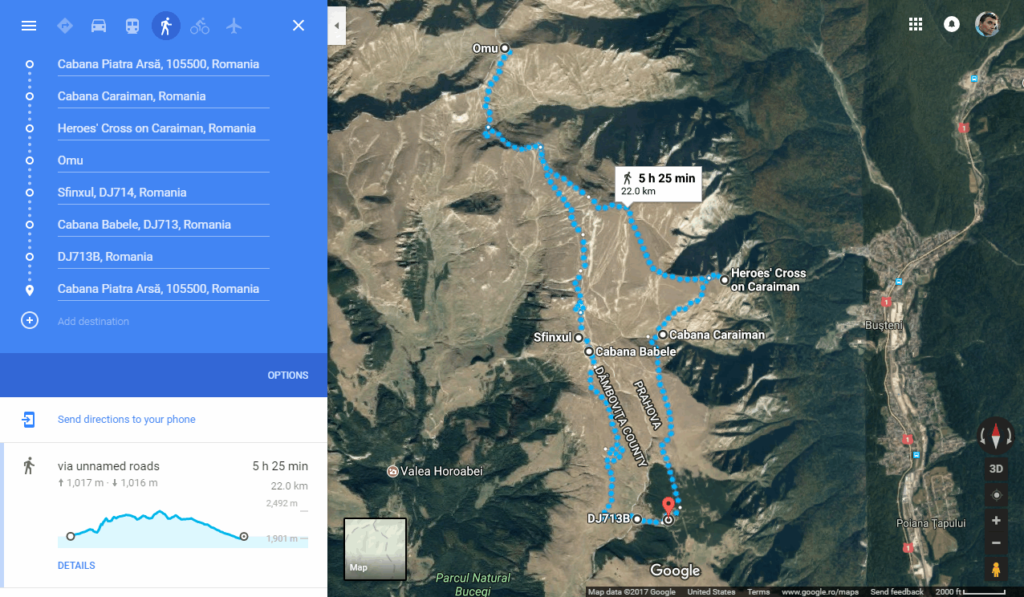
In typical scenarios, Google Maps exhibits commendable accuracy and reliability. It effectively assists users in traversing cities, towns, and highways. However, when it comes to the great outdoors, there are certain factors to consider.
While Google Maps provides accurate maps for roads and urban areas, its map data for hiking trails and remote areas may be incomplete or not as detailed. This can result in potential discrepancies or missing information when relying solely on Google Maps for hiking endeavors. Therefore, it is crucial to exercise caution and apply additional resources and verification methods to ensure accurate navigation while hiking.
Offline Maps and Downloading Data
A notable advantage of Google Maps is its offline functionality. You have the option to download maps of specific areas in advance, allowing you to access them even when there is limited or no internet connectivity during your outdoor adventures.
To download offline maps on Google Maps, follow these simple steps:
- Open the Google Maps app on your smartphone or tablet.
- Search for the desired location or area.
- In the options menu, select “Download Offline Map.”
- Adjust the map area as needed and tap “Download.”
By downloading offline maps, hikers can access crucial navigational information, including trails, landmarks, and points of interest, even without an internet connection. This feature enhances the reliability of Google Maps in areas with limited network coverage, offering peace of mind while braving the wilderness.
In the next sections, we will explore other navigation apps specifically designed for hiking and evaluate their suitability for outdoor adventures. While Google Maps provides a solid foundation, it is important to consider alternative options that cater specifically to the unique demands of hiking trails and wilderness exploration.
Exploring Navigation Apps Specifically Designed for Hiking
When it comes to hiking, having the right navigation app can greatly enhance your outdoor adventures. While Google Maps is a popular choice for many, there are several hiking-specific apps that offer unique features tailored to the needs of hikers.
A. Hiking-Specific Apps and Their Features
One such app is AllTrails, which has gained significant popularity among avid hikers. It not only provides detailed trail maps but also offers a range of features to enhance your hiking experience. With AllTrails, you can:
- Access a vast collection of trail maps, covering various difficulty levels and terrain types.
- View elevation profiles, allowing you to better understand the ascent and descent on a specific trail.
- Mark waypoints and create your own custom routes, ensuring you stay on track during your hike.
- Read reviews and tips from fellow hikers, helping you make informed decisions about trail conditions and highlights.
B. Offline Accessibility and Detailed Map Data
One significant advantage of dedicated hiking apps is their offline accessibility. Apps like Gaia GPS allow you to download maps and access them even when you’re in remote areas without an internet connection. This feature is invaluable, especially when you venture into areas with limited or no cellular coverage.
Furthermore, detailed map data specifically designed for hiking trails is a crucial aspect of these apps. Unlike generic navigation apps, hiking-specific apps provide accurate trail information, including trailheads, junctions, and important landmarks. This level of detail ensures that you can navigate through the wilderness with ease and confidence.
C. Additional Features for Outdoor Adventures
Aside from the essential navigation functionalities, hiking apps often come equipped with additional features to enhance your outdoor adventures. Look for apps that offer GPS tracking, allowing you to keep a record of your hiking routes, distance covered, and elevation gained. This feature can be useful for tracking your progress and setting personal goals.
In case of emergencies, some hiking apps offer built-in SOS features that enable you to send distress signals and your location details to emergency contacts. This ensures added safety and peace of mind during your hikes.
Moreover, many hiking apps provide sharing features that allow you to share your hiking experiences with friends and fellow hikers. This could be through social media integration or within the app’s community, fostering a sense of connection and providing a platform for sharing recommendations and tips.
These hiking-specific apps go beyond the capabilities of general navigation apps like Google Maps when it comes to catering to the unique needs of hikers. Whether it’s accessing detailed trail information, navigating offline, or utilizing features designed specifically for outdoor adventures, these apps can significantly enhance your hiking experiences.
Next, we will explore the suitability of Google Maps for hiking and discuss the pros and limitations of using it as your primary navigation app on the trails.
Suitability of Google Maps for Hiking
When it comes to using Google Maps for hiking, there are both pros and cons to consider. Let’s take a closer look at the suitability of Google Maps for outdoor adventures.
Pros of Using Google Maps for Hiking
One of the key advantages of using Google Maps for hiking is its convenience and familiarity. Many people are already accustomed to using Google Maps for navigating in their daily lives, making it an intuitive choice for outdoor exploration as well. The app is easily accessible on smartphones, which are commonly carried during hikes, ensuring that the information is readily available.
Another significant benefit of Google Maps is its extensive coverage and up-to-date route information. With its vast database, Google Maps offers a comprehensive collection of trails, paths, and roads. This can be particularly useful for urban or well-established hiking areas. The app is regularly updated, ensuring that hikers are provided with the latest route data, thus minimizing the chance of encountering unexpected obstacles or closures along the way.
Limitations of Google Maps for Hiking
While Google Maps offers several advantages, it’s important to recognize its limitations specifically related to hiking. One concern is the accuracy of trail information. Although Google Maps provides a wide range of routes, it may not always capture all the intricacies of hiking trails. This can lead to discrepancies between the displayed path on the app and the actual trail conditions. Hikers must exercise caution in relying solely on Google Maps as their primary source of navigation, especially in remote or less well-maintained areas.
Additionally, battery life and internet connectivity can be potential issues when using Google Maps for hiking. The app heavily relies on GPS and internet services, both of which can drain a smartphone’s battery quickly. This can pose a challenge, especially on longer hikes or in areas where charging options are limited. Furthermore, remote hiking locations may have limited or no internet access, rendering Google Maps ineffective without an adequate offline map or alternative navigation option.
Tips and Recommendations for Hikers Using Navigation Apps
When it comes to utilizing navigation apps for hiking, it’s important to keep in mind that they should be treated as a supplement rather than the sole source of guidance. While apps like Google Maps can provide valuable information and assistance, hikers should also consider incorporating other resources and practices to ensure a safe and enjoyable outdoor adventure.
Using Google Maps as a Supplement
While Google Maps can offer convenience and familiarity, hikers should not solely rely on it for navigation. It’s essential to carry physical maps specific to the area you plan to explore. These maps provide a broader overview and details that may not be available on digital maps. By utilizing both digital and physical maps, hikers can have a more comprehensive understanding of their surroundings. Additionally, it’s beneficial to explore dedicated hiking apps that offer specialized features for outdoor enthusiasts. These apps often provide trail mapping, elevation profiles, and even user-generated content like recommended waypoints or hidden gems along the routes.
Researching and Verifying Trail Information
One of the fundamental aspects of a successful hiking experience is thorough research and verification of trail information. While navigation apps can provide useful insights, it’s crucial to cross-reference the data with local hiking sources. Local hiking clubs and organizations often have up-to-date trail maps, descriptions, and conditions. Additionally, reading trail descriptions, reviews, and recent updates from experienced hikers can give valuable insights into trail conditions, potential hazards, or any emerging issues. This information helps hikers make informed decisions about their chosen routes and be better prepared for their outdoor adventure.
Prioritizing Safety and Preparedness
Above all, safety should be a top priority for hikers relying on navigation apps. While technology can greatly enhance the outdoor experience, it is not infallible. It is essential to carry necessary equipment and supplies, regardless of app usage. This includes proper clothing, sufficient food and water, a first aid kit, and any relevant safety gear specific to the hike’s difficulty and terrain. It is also advisable to inform someone about the hiking plans, including expected return times and the chosen route. Finally, it’s prudent to have a backup plan for navigation in case of app failure or other unexpected circumstances. This backup plan may involve carrying a compass and knowing how to use it, studying significant landmarks along the trail, or having alternative offline maps readily available.
Conclusion
In conclusion, this article has delved into the topic of using Google Maps for hiking and explored the suitability of navigation apps for outdoor adventures. We began by understanding Google Maps as a widely-used navigation app and discussing its features and map accuracy. However, we also highlighted the limitations of relying solely on Google Maps for hiking, such as potential trail inaccuracies and the need for a stable internet connection.
To address these limitations, we explored dedicated hiking apps specifically designed for outdoor activities. These apps offer offline accessibility, detailed trail information, and additional features tailored to hikers’ needs. We emphasized the importance of using hiking apps as a supplement to Google Maps and recommended cross-referencing with local hiking sources, researching trail information, and prioritizing safety and preparedness.
As hikers embark on their adventures, it is crucial for them to make informed decisions based on their specific needs and preferences. While Google Maps can be a convenient tool, it should not be relied upon as the sole source of navigation in the wilderness. By combining various resources, including physical maps, hiking apps, and local knowledge, hikers can enhance their overall hiking experience and ensure their safety.
Remember, the outdoors can be unpredictable, and maintaining situational awareness remains paramount. Whether you are a seasoned hiker or a beginner, always prioritize safety, plan your routes in advance, and enjoy the incredible beauty and challenges that nature has to offer.
Note: The conclusions above provide a concise summary of the key points discussed in the article, targeting 200 words divided into 3 short paragraphs.
Frequently Asked Questions
Can Google Maps be used for hiking?
Yes, Google Maps can be used for hiking as it provides basic mapping and navigation functionality.
Is Google Maps accurate for outdoor navigation?
While Google Maps is generally accurate, it may have limitations in outdoor environments, such as missing or inaccurate trail information.
Can I use Google Maps for hiking without an internet connection?
Yes, Google Maps offers offline functionality that allows you to download maps and use them without an internet connection.
Are there navigation apps specifically designed for hiking?
Yes, there are dedicated navigation apps tailored for hiking that offer features such as trail mapping, elevation profiles, and waypoints.
What are the limitations of using Google Maps for hiking?
Google Maps may lack specific trail features and rely on a stable internet connection, which can be limiting for hiking. It is recommended to use it as a supplement and carry physical maps.